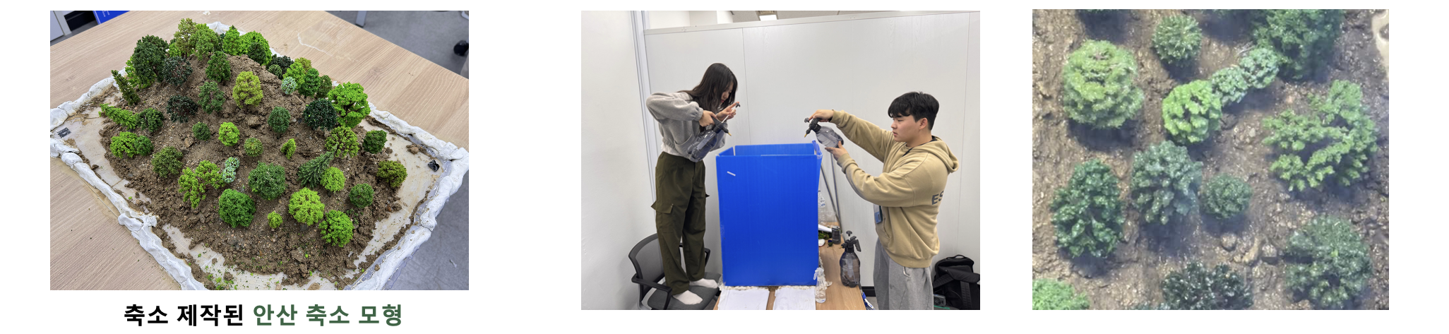
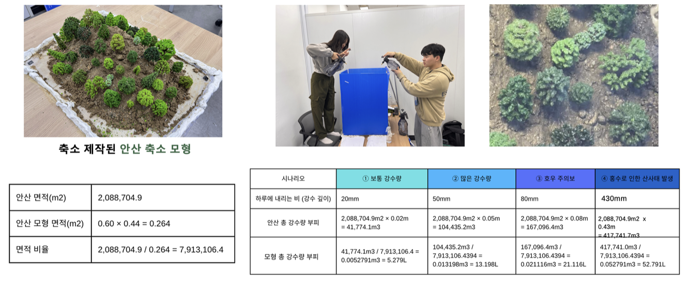
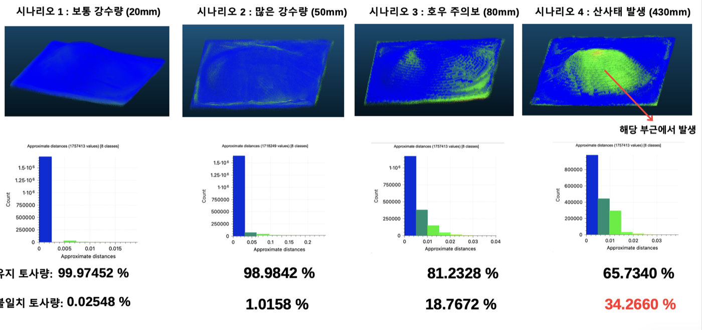
A digital twin for landslide risk assessment. I modeled a target region (Ansan) as a scaled physical model, preserving its real catchment geometry, and simulated rainfall scenarios from normal precipitation to flood-induced landslides to see which slopes and drainage paths turn failure-prone first, before that intensity is ever observed in the field.